More non-global warming in the Arctic
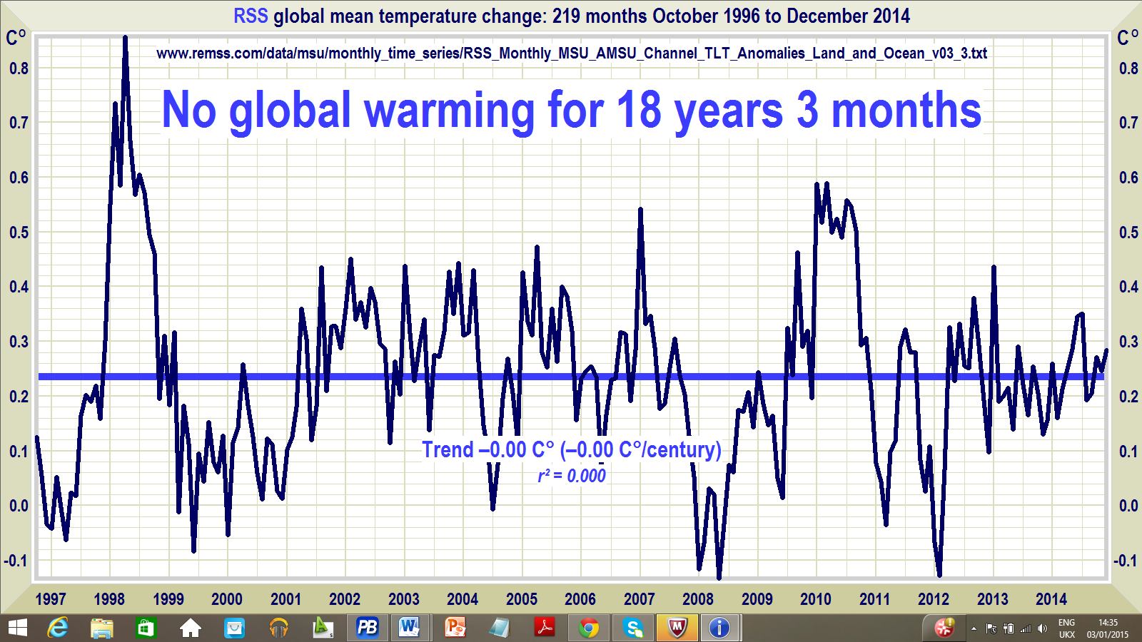
It always amuses me when Leftists seem to get erections over warming in the Arctic that is out of step with global temperatures. They seem to think that a non-global event is proof of a global event, even when there is demonstrably nothing global going on. It surely shows both a profound lack of logic and a need to believe. They mock Christians for their beliefs in the invisible but they too in fact believe in invisible events. They see warming that is not there. That graph again:

Some VERY out-of-step Arctic events are reported below. This time however, an explicit connection with global warming is not made, though all the excitement about it is presumably meant to make you think that something important is going on. Maybe logic eventually finds its way even into a Warmist skull. That the Arctic is anomalous because of the powerful volcanoes underneath much of it (e.g. along the Gakkel ridge) is not mentioned, of course.
The North Pole is experiencing a heatwave as temperatures came close to melting point yesterday, making the Arctic region warmer than some major cities in Europe and the US.
According to ocean measurements from the North Pole Environmental Observatory, the mercury tipped -1.9°C (28.6°F) on Wednesday as the Arctic bathed in an unseasonably warm spell.
The hike in temperature is reportedly due to the same low pressure system which has brought flood chaos to England and Scotland, and made areas of the Arctic up to 35˚C (63°F) warmer than the seasonal average.
Earlier this week, meteorologists tracking the path of a powerful North Atlantic storm over Iceland had forecast that the Arctic temperatures could peak above freezing, with the storm being one of the strongest on record and wind speeds of up to 230mph (370km/h).
Typically, the Arctic would be expected to be somewhere in the depths of up to -35°C (-31°F) in December, with 24 hour darkness.
ARCTIC HAS WARMEST YEAR IN HISTORY
Earlier this month, the average air temperature over Arctic land reached 2.3°F (1.3°C) above average for the year ending in September.
That's the highest since observations began in 1900.
The new mark was noted in the annual Arctic Report Card, released Tuesday by the National Oceanic and Atmospheric Administration.
The Arctic centres on the North Pole and reaches into North America and Eurasia.
But while large fluctuations of up to 30°F in air temperature are fairly typical in the Arctic, this latest weather system was expected to push the variability to as high as 50°F or 60°F.
Although no instruments for measuring temperature are operating on the North Pole to provide precise reading for the temperature spike, experts indicate temperatures may have pushed past zero.
Data pulled from one ocean buoy in the Arctic reported a temperature spike of 0.7°C, but Ryan Maue, a meteorologist at US company Weather Bell said on Twitter this data may have a large range of uncertainty.
Meteorologist Bob Henson, from WeatherUnderground, added that the December temperatures at the North Pole have only reached or gone above freezing just three times since 1948, but none during between January and March.
By comparison, yesterday's lowest temperature in Vienna was -1°C (-30°F) while Chicago was -2°C (28°F).
The same low pressure system responsible for the Arctic warmth is responsible for Storm Frank, which hit the UK with winds of 85mph (137km/h).
BBC weatherman Simon King, tweeted: 'A bit warm at the North Pole! Thanks to Storm Frank the temp is a very rare +1°C compared to the average -28°C.'
More weather disruption is expected over the New Year.
A larger than expected El Nino event in the Pacific Ocean is disrupting air currents, which is having a knock on effect on weather patterns around the world, including the North Atlantic.
Monitoring the weather event from space, Nasa has warned that satellite data indicate that this year's El Nino could be as strong as that of 1997 and 1998 which was the strongest on record.
The phenomenon is the result of a shift in the distribution of warm water in the Pacific Ocean around the equator.
Usually the wind blows strongly from east to west, due to the rotation of the Earth, causing water to pile up in the western part of the Pacific. This pulls up colder water from the deep ocean in the eastern Pacific.
However, in an El Niño event, the winds weaken and the warmer water to shift back towards the east. This causes the eastern Pacific to get warmer.
As the ocean temperature is linked to the wind currents, this can cause the winds to grow weaker still and so the ocean grows warmer, meaning the El Niño grows.
The effects of this year's El Niño event could extend well into 2016, causing further weather chaos.
SOURCE
Posted by John J. Ray (M.A.; Ph.D.).
No comments:
Post a Comment